
EXHIBIT SIGN:

WHAT WASN’T SAID:
1. That many people sailed the Indian Ocean, and other cultures’ accomplishments were ignored.
2. That the history of navigation in the Indian Ocean goes back about 4,000 years ago, during the days of Pharaohs, when the Egyptian seafarers sailed to the country of Punt, the coast of Somalia or the Mozambique coast of gold and incense; and the Sumerians and Jews who were traversing the Persian Gulf.
3. Maritime links between the ancient city of Lothal in India and Mesopotamia are known to have existed, and other traders in the Western Indian Ocean were the Phoenicians, Greeks, and Romans.
FACTS:
The results of human genetic and archaeological research provide us with indirect evidence for the early use of water transport around the Indian Ocean, showing they began to move out of Africa more than 100,000 years ago…a distinct stream of modern humans crossed from the Horn of Africa to the Arabian peninsula and then spread around the rim of the Indian Ocean, eventually reaching Australia, perhaps by 80,000 BP (before the present).
EXHIBIT SIGNS:
WHAT WASN’T SAID:
That the Jewish Talmud teaches that the earth is round and the astrolabe is a Jewish invention. To see a Jewish astrolabe click here Hebrew Astrolabe

FACTS:
1. Judaic savants were largely responsible for the invention and development of the instruments and astronomical tables that thereafter facilitated world-girdling sea voyages. The Zohar (Leviticus 1.3) was more specific about the earth’s rotating on its axis like a ball; Maimonides and other medieval Judaic scientists subscribed to that concept.
2. Intercontinental trade was pioneered by Persian Jews who pioneered the “Silk Route” to the heart of China in the 5th BCE. Augustus, first Roman emperor, is said to have commissioned “the first travel guide” from Isidore of Charax (a town on the Euphrates River estuary on the Persian Gulf). Centuries later, while the Europeans were still deep in the Dark Ages, Persian Rhadanite (Medieval Jewish merchants) scholar/travelers pioneered land and sea trade routes to the Far East.
3. “These merchants speak Arabic, Persian, Roman, Frankish, Spanish, and Slavonic,” wrote Ibn Khurdadhih in the ninth century CE, “They travel from East to West and from West to East by land as well as by sea.” They also spoke Hebrew and Aramaic.
4. Astronomical tables were similarly compiled by Joseph ben Wakkar at Toledo in 1396, and in Aragon by various Judaic specialists. Other significant calculations were made by Emanuel ben Jacob (aka Bonfils de Tarascon).The tables were used along with an astrolabe, an instrument introduced into the Arab-speaking world by a remarkable Jewish genius, Mashala of Mosul, “the phoenix of his age.” The use of the astrolabe, an instrument for taking the altitude of heavenly bodies, in conjunction with the astronomical tables, helped determine a ship’s position at sea.
EXHIBIT SIGN:

WHAT WASN’T SAID:
1. That the advanced model designed by Rabbi Joseph bn Makhir was used by Copernicus and Kepler.
2. That the most notable cartographers were found among the Jews, and the most advanced cartographer was a Jew who was forced to convert to Christianity. Christopher Columbus’s cartographers and other companions may have been
FACTS:
1. The quadrant, another device important for navigation on the high seas, measured the right ascension (angle from the horizon) of the sun and stars. An advanced model, designed by Rabbi Joseph bn Makhir, became known as the Quadrant Judaicus. Rabbi Makhir compiled the calendar used by Dante, and was quoted as an authority, long after his passing, by Copernicus and Kepler.
2. Rabbi, Levi ben Gershom, in southern France, devoted 136 chapters to astronomy in his major work, The Wars of the Lord; it included an improved quadrant, Jacob’s Staff, that Renaissance explorers depended on for determining latitude and local hour.
3. The most notable cartographers could be found among the Jews. Geographic intelligence was a boon of Judaic dispersion into the Diaspora. Information gleaned by Judaic travelers, deposited with compatriots along their itinerary, was transmitted to other passing Judaic travelers. Geographic intelligence was likewise passed along through correspondence delivered by these travelers from region to region.
4. Majorca, midway between Africa and Europe, became a beehive of Judaic mapmaking; Majorcans were unrivaled seafarers and Jews became their cartographers par excellence. A Jew, Jehuda, forced to convert to Christianity, produced the most famous mapamundi (world map) of the Atlantic coasts and mysterious oceans beyond. He became the first director of the famous nautical observatory in Portugal. Another convert and cartographer authored another famous mapamundi, used by Amerigo Vespucci.
5. Abraham Zacuto (1452-1515) was the most reputable astronomer of the day (University of Salamanca) and possible voyages of Columbus, and instructed Columbus on the use of the perfected astrolabe, which also became the standard in subsequent voyages by all colonialist adventurers, including the ships of Vasco de Gama.
EXHIBIT SIGNS:


WHAT WASN’T SAID:
1. That Polynesians were the finest navigators of the time.
2. Vasco de Gama owed his successful voyages and fame to the astrolabe and the mapamundi.
3. That Marco Polo was the most famous, but not the first, European to reach China. Others had preceded him and were living under Mongol rule, some in servitude.
EXHIBIT SIGN:

WHAT WASN’T SAID:
That the Kemal was not the first or the only type of navigational device in use; sailors were quite ingenious:
- The first seafarers kept in sight of land: follow the coast, lining up the landmarks.
- The Greeks learned to navigate from one island to the next by following clouds, which form over land, or odors that carry far out to sea.
- The Phoenicians looked to the heavens – the sun’s movement across a cloudless Mediterranean sky gave direction and quarter, meaning east and west, Asia and Europe. At night, they steered by the stars, finding fixed “heights” by measuring fingers laid horizontally one over the other.
- Ionian sailors navigated by the Little Bear constellation 600 BC.
- Norsemen watched the summer stars, and the behavior of birds.
- Eskimos studied the snow and Polynesians, whose navigational feats arguably have never been surpassed, watched the waves.
- Seafarers of the Marshall Islands built ingenious, elaborate maps of palm twigs and shells, denoting everything from the island to the prevailing direction of the swell.
- Alexandrian astronomer Ptolemy created the first world atlas in 2 AD, plotting latitude and longitude lines; he was preceded by the Greeks, who described trading routes as far east as India.
- By the 10th, Italian-made portolans supplied detailed directions, distances, depths, coastal description and, by the 13th c., sea maps with scale and bearings began to appear.
- The greatest advance in navigation came with the Chinese compass; the Chinese knew about magnetism as early as the 3rd millennium BC. The first western compass was mentioned in 1187.
- Indian traders rode the northeast monsoon to Africa and the southwest monsoon back to the subcontinent. Polynesians also hitched rides on prevailing winds.
- Phoenicians to the Polynesians measured the height of the sun and stars over the horizon, using the gnomon.
- The Arabians used the Kemal, as described, to determine latitude.
- In the Middle Ages, sailors relied on the astrolabe.
EXHIBIT SIGN:

WHAT WASN’T SAID:
That the dhow is the generic name of a number of traditional sailing and trading vessels with more than one mast. Although some historians claim the dhow was invented by Arabs or Indians, the majority give credit to the Chinese, dating back to between 600 BC to 600 AD. Some claim the sambuk dhow may be derived from the Portuguese
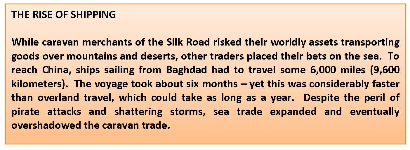
EXHIBIT SIGNS:

WHAT WASN’T SAID:
1. That the risk to caravan merchants of the Silk Road might have been the perils imposed by Muslims, known for their attacks, seizing ships, kidnapping, enslavement, and plunder for booty.
2. The First Barbary War (1801–1805), also known as the Tripolitan War or the Barbary Coast War, was the first of two wars fought between the United States and the Northwest African Berber Muslim states known collectively as the Barbary States. They were fought because U.S. President Thomas Jefferson refused to pay the high tributes demanded by the Barbary States and because they were seizing American merchant ships and enslaving the crews for high ransoms. It was the first declared war that the United States fought on foreign land and seas.
3. The Tripoli Monument, the oldest military monument in the U.S., honors the heroes of the First Barbary War.
EXHIBIT SIGN:

WHAT WASN’T SAID:
That Timothy Severin replicated a voyage that was sailed by a man who never existed.
