

Good analysis but I would expect nothing less here!
Guest Post by Bob Tisdale
The region east of the Philippines stands out on satellite-based sea level trend maps. See Figure 1, which is from the Map of Sea Level Trends webpage from the University of Colorado Sea Level Research Group. I’ve also shown the coordinates of the region that border it.

Figure 1
THE UNUSUAL SEA LEVEL RISE EAST OF THE PHILIPPINES APPEARS TO BE ENSO RELATED
That small pocket of extraordinary sea level rise looks like the remnants of a slow moving off-equatorial Rossby wave, or a series of them.
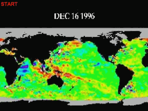
During an El Niño, a huge volume of warm water travels from the western equatorial Pacific to the east. See the animation here. That animation shows the evolution of the 1997/98 El Niño and its impacts on sea level residuals, starting with the two initial Kelvin waves carrying warm water east.
The El Niño does not consume…
View original post 1,008 more words
