Hurricane Ian Hits South Carolina


Posted originally on the conservative tree house on September 30, 2022 | Menagerie

For all our South Carolina Treepers, our prayers are with you. We hope all in the path of Ian are able to weather the storm well and safely. As you are able, check in and let us all know you guys are okay.

According to ABC news, Ian made landfall just after 2 p.m. today as a Cat 1 hurricane with winds at 85 mph.

Hello from Florida & Fake News


Armstrong Economics Blog/Opinion Re-Posted Sep 29, 2022 by Martin Armstrong

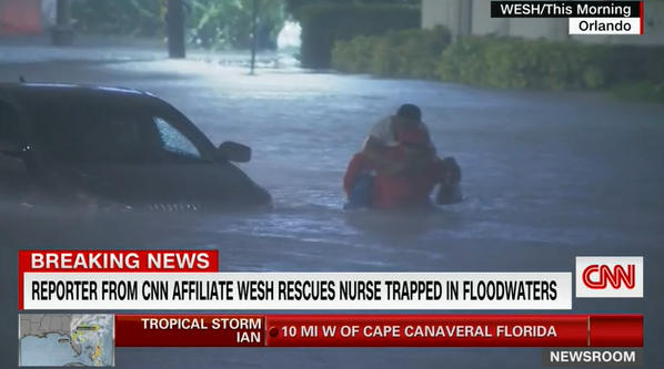
Thank you for all the emails of concern. I am fine. My dog is fine. Never lost power and nothing damaged. All of the newscasters go to the worst possible spots they can find and just stay there showing the very same backdrop all the time. The problem with such sensational broadcasting is that the vast majority of people no longer trust the media so when they play up a storm, so many people no longer trust the forecasting and do not evacuate.

This was Anderson Cooper standing in waist deep water while the camera crew was on high ground from 10 years ago. This is standard. I see the same reporter standing in the same spot on FOX with boats piled up. They never move from the most dramatic spots so you never see the whole region. It is no longer about reporting news. It is also about drama.

The people in South-West Florida were hard hit. By Tampa, the wind blew the water out of the bay, when it came back, it was just normal. No 10 ft wall of rushing water.

I really wish all the news channels returned to reporting the news instead of you will die in 3 hours so tune in so we can tell you the minute you will die so you can make your last phone call.

It has gotten to the point that you just do not know what to believe any more. That is causing people to lose their lives because they perhaps really should have evacuated, but did not because the last time the news dramatized the event then nothing happened.

I suffered no flooding, no power outage. From about Tampa northward on the West Coast, we were generally untouched. My cousin moved down here from New York, and he too was perfectly fine and never lost power.

Where Ian made landfall, that is the place people were hard hit. Inland, low lying levels were flooded because of the heavy rain. It would be nice if ALL the news channels realize that they have a responsibility to report a balanced view, not fixed on one spot that is the worst possible place to dramatize the news to get viewers. That is what is costing lives – crying wolf as they say. Just report the truth. They are costing lives with this dramatization. The last one CNN reported there would be a huge 10 to 15 wave, that amounted to 1.5 feet. So you stop listening after a while.

Hurricane Ian Recovery Update


Posted originally on the conservative tree house on September 29, 2022 | Sundance 

I don’t even know where to begin.  Hopefully this hotspot holds up long enough to transmit.  Thanks Ad Rem for earlier.

First things first, myself and family are okay.  We are blessed and fortunate.  Thank you for all your thoughts, prayers and well wishes.

For those who are familiar with Hurricanes, Ian was unique; painfully slow and painfully unique.  However, it had similarities to three previous storms, Frances (location), Michael (intensity) and Andrew (aftermath).   What made Ian very unique was the duration.

Normally there is 1 hour scary, 1 hour hell, 1 hour scary.  Soup to nuts three to four hours.   For Ian, that was just the first half.  With a start time around 1:30pm and a finish time around 9:30pm this one was brutal.  That’s why so much infrastructure failure.

When I saw the search and rescue flight path overhead at daybreak this morning, I knew the barrier Islands were catastrophic.  Indeed, Fort Myers beach, Sanibel Island, Upper Captiva and Pine Island all suffered topography changing events.   People will reevaluate living on barrier islands.

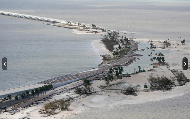
The Sanibel Causeway is destroyed.  The three spans still exist, but the spoil islands which held the road are totally wrecked.  No way on/off the island by vehicle.  The Pine Island bridge also failed.  The only way to Sanibel or Pine Island is by boat.  The dozens of air national guard flights today were all heading to those locations.  Regional Southwest Airport (RSW) remains closed except for rescue flights.

Several major piers are also gone.  Fort Myers Beach, Cape Coral, Pine Island.  At this moment 98% of Lee County, Florida is without power and there are major utility infrastructure failures.  Electric sub stations completely wiped out.  Utility water pumping stations also ruptured and failed.  Cell phone towers also wiped out.

The entire shrimp boat fleet docked at FM Beach was destroyed.  Boats now sit on houses with trailers on top of the boats and mobile homes from somewhere on top of the houses, boats and trailers.

Most people are shell-shocked at the scale of the damage from this storm.  Indeed, I doubt there is a community in Southwest Florida that not massively effected.  Marco Island, Naples, Bonita Springs, Fort Myers, Cape Coral, Punta Gorda, Port Charlotte and all of the inland communities all feel the impact from a major hurricane evdident.

Locally, it’s even more stunning.  We haven’t even left the neighborhood today and couldn’t even if we wanted to.  Roads are blocked by trees and debris.  When you think of debris, normally we think about small bits of stuff the size of a shopping cart or smaller.  Ian moved debris weighing tons.  Chunks of concrete from who-knows-where can be found randomly all over.  Concrete slabs from collapsed seawalls are blocks away from the water.

Every direction of wind was just as intense as the direction before it and we felt every direction.  As the front of Ian made debris, the backside then had ammunition for wind weapons of jaw-dropping scale.  The sounds of that “stuff” slamming into homes was just incredible.  Casa del Sundance has serious steel shutters with double drilled anchor bolts and several of my shutters were hit by something turning them into crash test discards.  Just, well and unreal amount of wind power.

Like many others, we had our roof compromise in the second half of the storm. Massive trees that withstood Charley and Irma were no match for Ian’s rage.   Thankfully, many people evacuated.  If you are one of those people, stay put.  Wait until after the weekend before making a decision to return home.  Heck, there ain’t no power or water anyway – and word on the street is no gas for miles.

Like hurricane Michael, this was a storm of total utility failure.  It could take weeks, depending on the neighborhood because the transfer and sub stations were hit hard.

Today was all about debris removal and that work will obviously continue.  It’s easy to be overwhelmed, but industrious people doing the next step, then the next, is the way to get it done.  How do you eat an elephant…..  One bite at a time.   Lots of bites to go.

As noted, the coastal areas took it worst. My gut tells me there are still places we have yet to hear about.

Another odd thing about this specific storm, an alarmingly fewer number of generators running.  Easily 75% fewer generators running in the aftermath around me.  Perhaps because the outcome was just too bad to try and inhabit while recovering; perhaps more evacuated this time; perhaps with the economy means fewer financial resources to try and cope.  Regardless of reason, the drop in the number of people running generators is odd.

Tomorrow, we continue to put a few more layers on those callouses.  After mostly securing the immediate homestead, we can now look to help others.   This is going to be one long recovery effort.

Thanks again for all the well wishes.  Love to all,

Sundance

For A Friend (and all who now suffer from Ian)


Posted originally on the conservative tree house on September 29, 2022 | Menagerie

For Sundance, who never fails to give thanks, in all circumstances. He has posted versions of this many times.

Posted in Uncategorized

Managing Expectations, Hurricane Ian 11pm Update – Now it is Time to Hunker Down


Posted originally on the conservative tree house on September 28, 2022 | Sundance

As many long-time readers will know, we do have a little bit more than average experience dealing with the aftermath of hurricanes. I am not an expert in the before part; you need to heed the local, very local, professionals who will guide you through any preparation, and neighborhood specific guidelines, for your immediate area.

But when it comes to the ‘after part’, well, as a long-time CERT recovery member perhaps I can guide you through the expectation and you might find some value.

Consider this little word salad a buffet. If you are new to Florida hurricanes, absorb what might be of value pass over anything else.

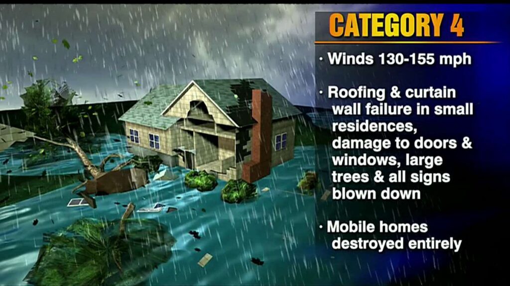
A category-4 storm can and will erase structures, buildings and landscape.

Hurricane Ian is similar to Hurricane Charley which impacted the SW coast of Florida in 2004, only a longer duration and therefore worse.  The coastal topography and barrier islands will likely change in the 40-mile-wide area of immediate impact.

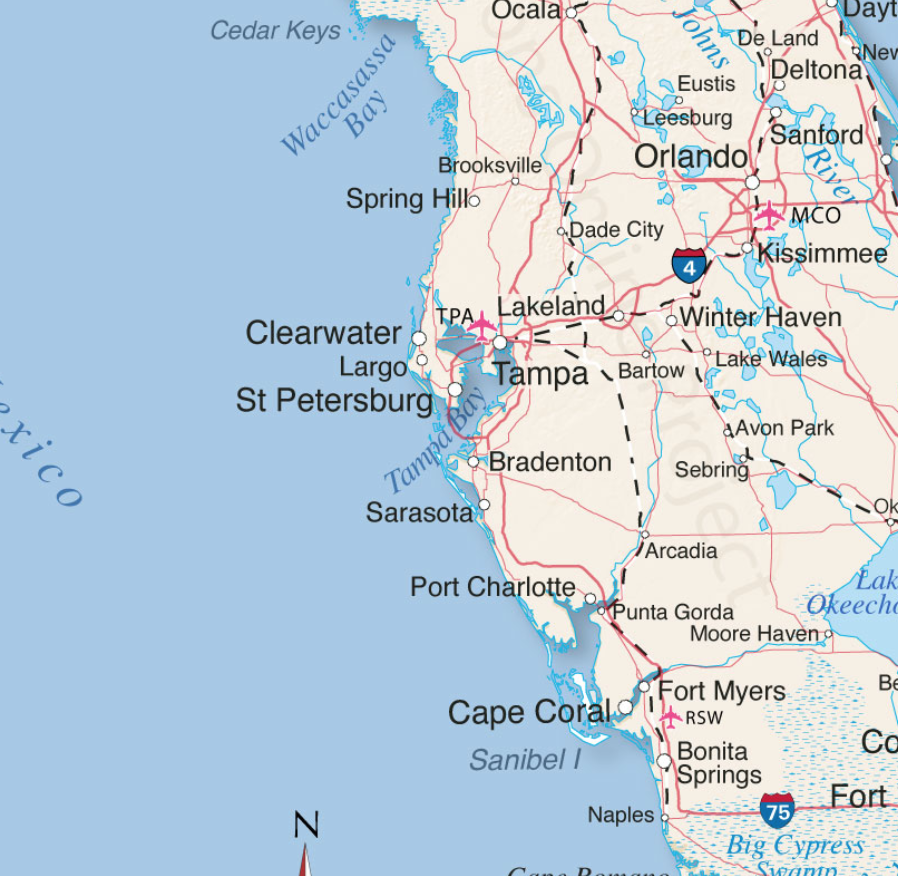
Sanibel Island, Bonita Beach, Fort Myers Beach, Captiva, Upper Captiva, Boca Grande, Pine Island, Cape Coral, Siesta Key, Longboat Key, Charlotte Harbor and Pine Island Sound could all be impacted.

There is the potential for 18+ hours of hurricane force winds and two tides with storm surges.  Total infrastructure failure should be anticipated, and it will take weeks for restoration. The coastal communities are the most vulnerable; however, the inland impact of the storm will continue unimpeded until the eyewall crosses onto land.

That means communities inland for roughly 50 miles could likely see consistent hurricane force winds for several hours. That scale of sustained wind energy will snap power poles and weaken reinforced concrete.

As the backside of the storm then reverses the energy direction, any already compromised structures will not withstand the additional pressure. In many cases the backside of the storm is worse than the front.  If you are inland, you too should prepare yourself for long duration of extensive wind damage followed by an extended power outage.

For those who are in the path of the storm, there comes a time when all options are removed, and you enter the “Hunkering Down” phase.  You’re there now.

Ian is forecast to approach the west coast of Florida as an extremely dangerous major hurricane. Hurricane-force winds extend outward up to 40 miles (65 km) from the center and tropical-storm-force winds extend outward up to 140 miles (220 km). (link)

Unfortunately, unlike Charley, this particular hurricane Ian will stick around for more than the 2+ hours of the 2004 storm event.  That brings a serious problem with coastal storm surge (two tidal cycles).  In its totality from initial impact through recovery this is going to be a long-duration event.

When the sustained winds reach around 45mph only the more dire of emergencies get an immediate response.   It is almost a guarantee that around the time emergency responders stop responding, too dangerous, you will lose power from the storm.  Do not expect the power to be turned back on until it is safe, in this example recovery will be delayed by the slow forward progress of the storm.

Hurricanes can be frightening; downright scary.  There’s nothing quite like going through a few to reset your outlook on just how Mother Nature can deliver a cleansing cycle to an entire geographic region.   The sounds are scary. Try to stay calm despite the nervousness.  Telephone and power poles, yes, even the concrete ones, can, and likely will, snap like toothpicks.

The ground in Southwest Florida is also completely saturated with heavy rains even before the storm began dumping water earlier on Monday.  Trees that previously withstood Irma and even Charley, could likely bend, uproot and break; the sounds are dramatic.

There’s a specific sound when you are inside a hurricane that you can never forget.  It isn’t a howl, it’s a roar.  It is very unique sound in depth and weight.  Yes, within a hurricane wind has weight.  Stay clear of windows and doors, and within an interior room of the house or apartment if possible.

That scary roar will sound like it will never quit, especially for this specific slow-moving hurricane.  It will stop, eventually; but at the time you are hunkering down, it doesn’t seem like it will ever end.  This is the part that makes people say they will never go through that again.  It is intensely unnerving.  Imagine being impacted by a tornado for a full day.

A hurricane wind is a constant and pure rage of wind that doesn’t ebb and flow like normal wind and storms.

Hurricane wind is heavy, it starts, builds and stays, sometimes for hours. This one is forecast to be the longest in my memory.  The wind is relentless, it just seems like it won’t let up.  And then, depending on Ian’s irrelevant opinion toward your insignificant presence, it will stop.

Judging by the forward speed being stated by professionals at the National Hurricane Center, the hurricane force wind will likely last around 18 hours before it stops.  Prepare your nerves as best you can for this.

Then silence.  No birds. No frogs. No crickets. No sound.

Nature goes mute.  It’s weird.

We have no idea how much ambient noise is around us, until it stops.

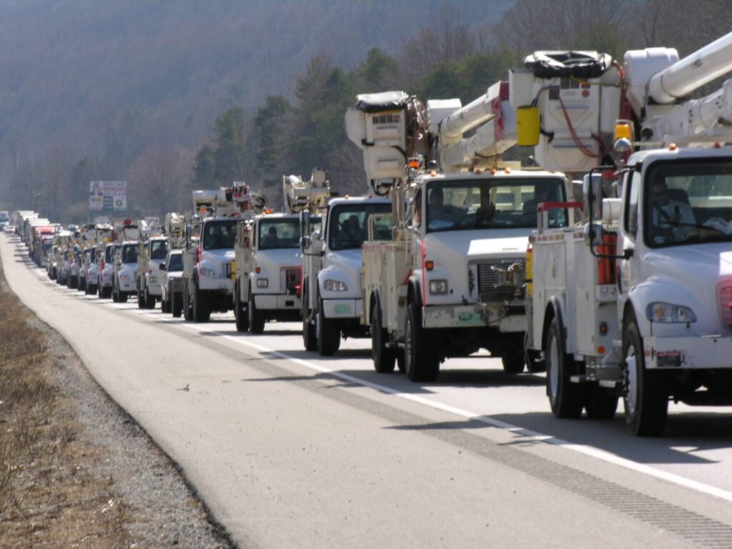
Due to the speed of this storm, there will be convoys coming to construct a pre-planned electricity grid recovery process around nightfall Thursday. Convoys from every city, town and state from the east-coast to the mid-west.  A glorious melding of dirty fingernails all arriving for the meet-up.   Depending on your proximity to the bigger picture objectives at hand, you will cherish their arrival.

But first, there will be an assessment.  The convoys will stage at pre-determined locations using radios for communication. Most cell phone services will likely be knocked out.  Recovery teams will begin a street-by-street review; everything needs to be evaluated prior to thinking about beginning to rebuild a grid.  Your patience within this process is needed; heck, it isn’t like you’ve got a choice in the matter…. so just stay positive.

Meanwhile, you might walk outside and find yourself a stranger in your neighborhood.

It will all be cattywampus.

Trees gone, signs gone, crap everywhere, if you don’t need to travel, DON’T.

I mean CRAP e.v.e.r.y.w.h.e.r.e.

Stay away from powerlines.

Try to stay within your immediate neighborhood for the first 36-48 hours after the storm passes.  Keep the roadways and main arteries clear for recovery workers, power companies and fuel trucks.

However, be entirely prepared to be lost in your own neighborhood and town for days, weeks, and even months.  Unknown to you – your subconscious mind is like a human GPS mapping system.  When that raging Ian takes away the subconscious landmarks I guarantee you – you are going to get lost, make wrong turns, miss the exit etc.

It’s kind of funny and weird at the same time.

Your brain is wired to turn left at the big oak next to the Church, and the road to your house is likely two streets past the 7-11 or Circle-k. You don’t even notice that’s how you travel around town; that’s just your brain working – it is what it is.

Well, now the big oak is gone; so too is the Circle-K and 7-11 signs.  Like I said, everything is cattywampus.  Your brain-memory will need to reboot and rewire.  In the interim, you’re going to get lost… don’t get frustrated.

No street signs. Likely no stop signs.  No traffic lights.

Remember, when it is safe to drive, every single intersection must be treated like a four-way stop…. and YOU ARE GOING TO HAVE TO PAY ATTENTION.  Even the major intersections.

You’ll need to override your brain tendency to use memory in transit.  You’ll need to pay close attention and watch for those who aren’t paying close attention.

Travel sparingly, it’s just safer.

Check on your-self first, then your neighbors. It doesn’t matter if you’ve never said a word to the guy in the blue house before.  It ain’t normalville now.

Break out of your box and check on the blue house down the street too.  In the aftermath, there’s no class structure.  Without power, the big fancy house on the corner with a pool is just a bigger mess.  Everyone is equally a mess.

The first responders in your neighborhood are YOU.

You, the wife, your family, Mrs. Wilson next door; Joe down the street; Bob’s twin boys and the gal with the red car are all in this together.  If you don’t ordinarily cotton to toxic masculinity, you will worship its appearance in the aftermath of a hurricane.  Git-r-done lives there.

Don’t stand around griping with a 40′ tree blocking the main road to your neighborhood.  Figure out who’s got chainsaws, who knows how to correctly use them, and set about safely clearing the road.  If every neighborhood starts clearing their own roadways, the recovery crews can then move in for the details.

Stage one focuses on major arteries… then secondary… then neighborhood etc.  It’s a process.

Oh, and don’t get mad if your fancy mailbox is ploughed over by a focused front-end loader who is on a priority mission to clear a path.  Just deal with it.  Those same front-end loaders will also be removing feet of sand from coastal roads.  Don’t go sightseeing… stay in your neighborhood.

For the first 36-48 hours, please try to stay close to home, in your neighborhood.  Another reason to stay close to home is the sketchy people who can sometimes surface, looters etc. Staying close to home and having contact with your neighbors is just reasonable and safer.

Phase-1 recovery is necessarily, well, scruffy…. we’re just moving and managing the mess; not trying to clean it up yet.  It’ll be ok.  There are going to be roofing nails everywhere, and you will likely get multiple flat tires in the weeks after the hurricane.

After this storm half of the people living near Cape Coral, Punta Gorda and Port Charlotte are going to fit into two categories, two types of people: (1) those with a new roof; or (2) those with a blue roof (tarp).

Keep a joyous heart filled with thankfulness; and if you can’t muster it, then just pretend. Don’t be a jerk.  You will be surrounded by jerks….  elevate yourself.  If you need to do a few minutes of cussing, take a walk.  Keep your wits about you and stay calm.

Now, when the recovery teams arrive…. If you are on the road and there’s a convoy of utility trucks on the road, pull over.  Treat power trucks and tanker trucks like ambulances and emergency vehicles.  Pull over, give them a clear road and let them pass.

When everyone gets to work, if you see a lineman, pole-digger or crew say thanks.  Just simple “thanks”.  Wave at them and give them a thumbs-up. No need to get unnecessarily familiar, a simple: “thank you for your help” will suffice.  You know, ordinary people skills.

Many of these smaller crews will be sleeping in cots, or in their trucks while they are working never-ending shifts.  Some will be staging at evacuation shelters, likely schools and such.  The need to shelter people and recovery crews might also delay the re-opening of schools.

Once you eventually start getting power back, if you see a crew in a restaurant, same thing applies… “thanks guys”.

Same goes for the tanker truckers. The convenience stores with gas pumps are part of the priority network.  Those will get power before other locales without power.  Fuel outlets are a priority.  Fuel is the lifeblood of recovery. Hospitals, first responders, emergency facilities, fuel outlets, then comes commercial and residential.

Remember, this is important – YOU are the first responder for your neighborhood.  Don’t quit.  Recovery is a process.  Depending on the scale of the impact zone, the process can take days, weeks and even months.

Take care of your family first; then friends and neighborhood, and generally make a conscious decision to be a part of any needed solution.

Pray together and be strong together.  Do not be bashful about being openly thankful in prayer.

It will be ok.

It might be a massive pain in the a**, but in the end, it’ll be ok.

√Andrew
√Jeanne
√Frances
√Ivan
√Charley
√Irma
√Michael
Ian

Keep a good thought.  Who knows, we might even end up shaking hands.

It will be OK.  Promise.

Hurricane Ian Projected Path Narrows, Local SWFL Radar Now Tracking – All Preparations Need to be Rushed to Completion


Posted originally on the conservative tree house on September 27, 2022 | Sundance

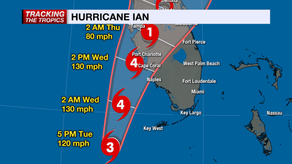
The projected path of Hurricane Ian, a category 4 storm, has now been narrowed.  Landfall is anticipated just North of Cape Coral in the Punta Gorda, Port Charlotte area.  Lee and Charlotte counties will likely feel greatest impact from Ian starting overnight through all day Wednesday, with eyewall entering Southwest Florida (SWFL) overnight Wednesday.

All preparations must be rushed to completion.  Power outages will likely start sporadically happening early to midday tomorrow (Wed).  Evacuation zones have been expanded due to increased storm surge prediction.  Pay close attention to your local officials and local media.  If you are staying in the Lee or Charlotte coastal area, now is the time to finish inside preparations.  Local SWFL radar is now tracking storm [Local Media Link].

Boca Grande Pass, famous for exceptional Tarpon fishing, looks to be the immediate coastal area where the greatest wind driven storm surge will impact.   Gulf water will be pushed up the Caloosahatchee and Peace rivers creating expanded flooding further inland.  The flooding and storm are anticipated to be the largest in SWFL history and are the greatest risk.

(NHC) – Maximum sustained winds remain near 120 mph (195 km/h) with higher gusts. Ian is a category 3 hurricane on the Saffir-Simpson Hurricane Wind Scale. Re-strengthening is expected later today through Wednesday. Ian is forecast to approach the west coast of Florida as an extremely dangerous major hurricane. Hurricane-force winds extend outward up to 40 miles (65 km) from the center. (more)

(NBC2 News) – Because of the location and movement of this hurricane, Lee and Charlotte and coastal Collier Counties are under hurricane warnings.  It is important to stress: DO NOT FOCUS ON THE CENTER OF THE FORECAST CONE. IMPACTS FROM THIS HURRICANE WILL EXTEND FAR BEYOND WHERE THE CENTER OF THE STORM IS. 

As of 5 p.m. Tuesday, the forecast cone has shifted east of where it was earlier today, meaning the potential of a Category 4 hurricane landfall is higher in Southwest Florida than it was 24 hours ago. (more)

Stage your battery powered lights and weather radios.

Turn down your refrigerator to its lowest setting anticipating power outage.

Freeze bottles of water to fill empty space in freezer.

Secure all important papers in waterproof bags and stage in central location.

Take a refreshing hot shower.

Fill cleaned and sanitized garbage cans with water in shower and/or bathtub.

Bring in outdoor furniture or throw it in the pool.

Put all your most critical items in an interior room without windows.

Put your most critical needed emergency items in easy reference place.

Elevate anything you might fear getting damaged from flooding.

Fully charge your portable electronics including cell phone.

Eat a good meal

Get rest tonight.  Do not allow yourself to be overcome with dark imaginings.

Florida Governor Ron DeSantis Gives Update on West Coast of Florida Evacuation Plans


Posted originally on the conservative tree house on September 26, 2022 | sundance 

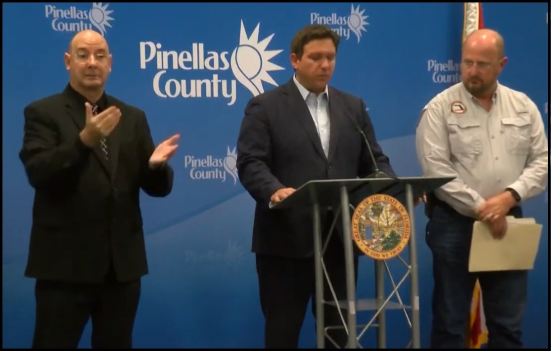
With the forecasted path of Hurricane Ian anticipated to bring high water and winds to the west coast of Florida there is the potential for major storm surge in specific regions. Florida Governor Ron DeSantis held a press conference from Pinellas County to outline the latest information. WATCH: 

 ~ Florida Disaster Website as Outlined ~

TALLAHASSEE, Fla. — This morning, Governor Ron DeSantis issued updates on Hurricane Ian at the State Emergency Operations Center with Florida Division of Emergency Management Director Kevin Guthrie. Full remarks from this morning’s press conference are available here.

Hurricane Ian became a Category 1 hurricane this morning and is projected to continue strengthening into a major hurricane this week. Tropical-storm force winds may begin as soon as tonight in the Florida Keys and southern Florida. Regardless of Ian’s exact track and intensity, there is a significant risk of life-threatening storm surge, hurricane-force winds, and heavy rainfall along the west coast of Florida and the Florida Panhandle by the middle of this week.

Current Watches and Warnings in Effect:

  • Tropical Storm Warnings are in effect for the Lower Keys (from the 7 Mile Bridge southward to Key West, and the Dry Tortugas).
  • Tropical Storm Watches are in effect for portions of the Florida Gulf Coast stretching from Englewood to Chokoloskee (Charlotte, Collier, and Lee Counties).
  • A Hurricane Watch is in effect for Englewood to the Anclote River, including Tampa Bay.
  • Storm Surge Watches are in effect for the Florida Keys and mainland Monroe County, as well as far southern Miami-Dade, Collier, coastal Lee, the Tampa Bay area and coastal Charlotte counties.
  • Anclote River to Longboat Key including Tampa Bay… 5-10 ft
  • Longboat Key to Englewood… 5-8 ft.
  • Englewood to Bonita Beach, FL… 4-7 ft
  • Bonita Beach to East Cape Sable, FL… 3-5 ft
  • East Cape Sable to Card Sound Bridge, FL including Florida Bay…2-4 ft
  • Florida Keys including the Dry Tortugas… 2-4 ft

State preparation and response efforts include:

Florida Division of Emergency Management (FDEM)

  • FDEM is leading the State Emergency Response Team (SERT) for the Hurricane Ian response.
  • The Division has received 361 resource requests for Hurricane Ian, and has already fulfilled 293 of those requests. Additional requests are currently being processed and are either en route or being mobilized. This includes the coordination of resources such as: trucks of food and water, generators, and water pumps.
  • Five Urban Search and Rescue (USAR) Teams are activated, and will be prepared to deploy to impacted areas.
  • FDEM has begun setting up a Logistical Staging Areas in Polk County and is identifying potential additional staging areas and points of distribution to ensure food and water are readily available if counties request it.
  • FDEM has loaded 360 trailers with over 2 million meals and over one million gallons of water in preparation for distribution to impacted areas.
  • FDEM is in constant communication with all 67 county emergency management offices and state agencies to coordinate protective actions and needed resources ahead of potential storm impacts.
  • FDEM is coordinating with utilities to ensure crews are prepared to respond and restore power. Utility providers have more than 25,000 linemen staged and prepared for power restoration efforts.

Florida National Guard

  • Following Governor DeSantis’ authorization, a total of 5,000 Florida Guardsmen are being activated to State Active Duty and pre-positioned at armories across the state for Tropical Storm Ian response operations. Two thousand Guardsmen from Tennessee, Georgia and North Carolina are also being activated to assist.
  • The Florida National Guard is currently supporting missions including staffing and supporting the State Logistics Response Center (SLRC) in Orlando.
  • In addition, the Florida Guard has mobilized and is on standby with five Route Clearance Teams and Aviation assets.
  • The Florida National Guard is well-equipped, with assets including high-wheeled vehicles, helicopters, boats, generators and more.

Florida Department of Health (DOH)

  • DOH continues to coordinate across 67 county health departments on any necessary preparation resources, in coordination with county emergency managers.
  • The Department has coordinated with the Office of Insurance Regulation to distribute an alert regarding permitted early prescription refills during a State of Emergency. This alert was sent to health insurers, managed care organizations, health entities, and licensed health care providers. The alert can be found here.
  • The Department is supporting Special Needs Shelter operations in areas of anticipated landfall.
  • Nearly 300 ambulances, paratransit busses, and support vehicles are being deployed in areas of anticipated landfall.
  • The Department has coordinated with Federal partners to support the deployment of nearly 100 individuals through various health and medical teams. These teams stand ready in Orlando, Atlanta, and Warner Robbins Air Force Base in Georgia.

Agency for Health Care Administration (AHCA)

  • AHCA is requiring health providers to update the Health Facility Reporting System by 10 AM daily to ensure each facility is taking the appropriate precautions to ensure patient safety.
  • AHCA has completed 124 onsite visits in Nursing Homes and ALFs that were previously identified as out of compliance with generator requirements. As of today, 100% of operating long-term care facilities have a generator on-site. The Generator Status Map for long-term care facilities is available here.
  • AHCA has reminded all Medicaid Managed Care Plans of the requirement to allow 30-day emergency prescription refills of maintenance medication.

Agency for Persons with Disabilities (APD)

  • APD sent a statewide message to remind customers to register for the Special Needs Registry if needed.

Florida Department of Children and Families (DCF)

  • DCF submitted a request for a federal waiver to release SNAP benefits early in preparation for Hurricane Ian.
  • DCF has been working with contracted partners, including, Managing Entities, Community Based Care lead agencies, and child care providers to ensure Florida’s communities remain apprised of all storm updates and are making preparations for potential impacts.
  • DCF is also ensuring all Mental Health Treatment Facilities and methadone treatment programs are prepared for the storm.

Florida Department of Veterans Affairs (FDVA)

  • The Bay Pines VA Healthcare System will close the following locations for in person and procedure appointments:
  • C.W. Bill Young VA Medical Center: Monday, Sept. 26 through Thursday, Sept. 29. This closure extends to the Emergency Department.
  • North Pinellas and St. Petersburg VA Clinics: Wednesday, Sept. 28 and Thursday, Sept. 29.
  • Sarasota, Bradenton, and Port Charlotte VA Clinics: Wednesday, Sept. 28.

Florida Department of Transportation (FDOT)

  • To help Florida families safely and quickly evacuate in preparation of Hurricane Ian, tolls are now being suspended on many facilities in the projected areas of impact. Tolls will be suspended as of 12:00 PM today for the following:
  1. Polk Parkway in Polk County
  2. Suncoast Parkway in Pasco, Hernando, Hillsborough, and Citrus counties
  3. Veterans Expressway in Hillsborough County
  4. I-4 Connector in Hillsborough County
  5. Selmon Expressway in Hillsborough County
  6. Pinellas Bayway in Pinellas County
  7. Sunshine Skyway Bridge in Pinellas County
  8. Garcon Point Bridge in Santa Rosa County
  9. Spence Parkway in Okaloosa County
  10. Mid-Bay Bridge in Okaloosa County
  11. Alligator Alley in Collier and Broward Counties
  • FDOT contractors on all active construction projects are securing work sites, clearing traffic control devices that are not actively being used to direct traffic, and checking drainage systems.
  • Additional Road Rangers have been deployed to assist motorists along critical roadways.
  • The SunRail corridor is being secured to prepare for the storm. SunRail services will be discontinued effective Tuesday at 8:30am and will tentatively resume on Friday morning.
  • Florida’s 511 Traveler Information System is available for drivers to stay informed about roadway conditions during emergencies. The service includes traffic conditions, road and bridge closures, toll suspensions, and other specialized alerts. To use Florida’s 511, visit the website at FL511.com or download the app—on both Apple and Android devices.
  • On Saturday, September 24, FDOT waived standard weight restrictions for commercial vehicles transporting fuel, emergency equipment, services, supplies, and agriculture commodities and citrus. Commercial vehicles now will have an increased weight restriction to transport goods.
  • FDOT is monitoring traffic levels along critical corridors to ensure safe flow of traffic as the storm’s predicted path becomes clearer.
  • FDOT is staging resources to perform road and bridge inspections after the storm.
  • FDOT is procuring and staging resources to perform cut-and-toss operations to expedite roadway openings after the storm.
  • FDOT is activating district emergency and pre-event contracts for post-storm operations including debris removal, traffic signal and lighting repairs, and generators.
  • FDOT is coordinating with the Florida Highway Patrol, other law enforcement agencies, and Georgia DOT partners in support of potential evacuations, as well as with the Florida Department of Environmental Protection regarding debris management sites.
  • FDOT is working with utility providers to coordinate post-storm debris operations in support of electrical power restoration.
  • FDOT is coordinating with U.S. Coast Guard on movable bridge lockdowns.

Florida Department of Highway Safety

and Motor Vehicles (FLHSMV)

  • The Florida Highway Patrol is prepared to implement 12-hour Alpha, Bravo shifts in response to Hurricane Ian.
  • FLHSMV has issued Emergency Order 092422, which:
    • Waives specific requirements for commercial motor vehicles providing emergency relief; and
    • Waives the replacement fees for driver’s license and identification credentials, vehicle registrations and titles, vessel registrations and titles and temporary parking permits for impacted individuals.

Florida Wildlife Commission (FWC)

  • On September 23, at Governor DeSantis’ direction, the Florida Fish and Wildlife Conservation Commission (FWC) readied high-water vehicles and all other storm response resources so they may be rapidly deployed to assist Floridians in need in the event of any damage or flooding.
  • FWC officers in all 67 Florida counties have been placed on heightened alert status, in anticipation of heavy rains and flooding because of Hurricane Ian. High-water vehicles and shallow draft vessels in all Florida counties have been readied for immediate deployment to affected areas. Contingency plans based on forecasted landfall locations have been developed and are flexible based on the storm’s projected path.
  • Officers will respond with a variety of specialized equipment, including shallow draft boats, larger platform vessels, ATVs, airboats, and four-wheel drive vehicles. These assets do not include local FWC officers in potentially affected areas.
  • FWC Special Operations Group (SOG) teams will serve as reconnaissance units for the State EOC and report back on damage after the storm has made landfall.
  • FWC Aviation Section has been placed on standby and has readied all appropriate aircraft for potential deployment for EOC aerial assistance, reconnaissance, and post-storm damage assessments when needed.

Florida Department of Economic Opportunity (DEO)

  • DEO has activated the private sector hotline at 850-815-4925 from 8:00 a.m. to 6:00 p.m. Inquiries may also be emailed to ESF18@em.myflorida.com.
  • Partners including Walmart and Publix have indicated that they are constantly bringing additional supplies into the state to restock inventory.
  • DEO is updating www.FloridaDisaster.biz with real-time information for business owners to prepare their businesses, families, and employees for Hurricane Ian

Florida Department of Environmental Protection (DEP)

  • Following the issuance of the Governor’s Executive Order, DEP issued an Emergency Final Order waiving permitting requirements for the storage and processing of solid waste, including storm debris.
  • DEP has also issued an Emergency Final Order to expedite necessary repair, replacement and restoration of structures, equipment, surface water management systems, works and other systems damaged by the storm.
  • Inspectors completed pre-storm beach surveys in all shoreline counties.
  • Hazardous Area Response Teams (HARTs) are preparing for potential assessment and deployment to impacted areas.
  • All significant Hazardous Waste facilities within the affected counties have been contacted to ensure all pre-storm landfall preparations are being made.
  • Florida state park closures can be found at www.floridastateparks.org/StormUpdates.
  • Visitors with existing camping and cabin reservations at impacted parks will be notified of their reservation status.
  • WaterTracker is active, DEP’s online portal for wastewater and drinking water facilities to report their operational status.

Florida Department of Education (DOE)

The Florida Department of Education is consistently updating their website with county school closures, for a list visit fldoe.org/storminfo.

K12 School Closures

  • Hernando County Schools will be closed Tuesday, September 27 through Friday, September 30, 2022.
  • Hillsborough County Schools will be closed Monday, September 26 through Thursday, September 29, 2022.
  • Lake County Schools will have early dismissal on Tuesday, September 27 and will be closed Wednesday, September 28 and Thursday, September 29, 2022.
  • Pasco County Schools will be closed Tuesday, September 27 and Wednesday, September 28, 2022.
  • Pinellas County Schools will be closed Tuesday, September 27 and Wednesday, September 28, 2022.
  • Sarasota County Schools will be closed beginning Tuesday, September 27.

Florida College System Closures

  • Hillsborough Community College will be closed Tuesday, September 27 through Thursday, September 29, 2022.
  • St. Petersburg College will be closed Tuesday, September 27 and Wednesday, September 28, 2022.
  • State College of Florida will be closed Tuesday, September 27 through Friday, September 30, 2022.

State University Closures

  • New College of Florida classes will be canceled Monday, September 26 through Friday, September 30, 2022.
  • University of South Florida classes will be canceled Monday, September 26 through Thursday, September 29, 2022. Campuses will be closed starting Tuesday, September 27, 2022.

Florida Department of Management Services (DMS)

  • State buildings in Hillsborough County will be closed tomorrow, Tuesday, September 27, 2022. An updated list of state building closures is available here.
  • The Telecommunications Division is working with telecom partners to ensure that the state’s communications networks have redundancies and remain operations for first responders to respond to Floridians during the storm.

Posted in FEMAHurricane IanRon DeSantisUncategorized

DeSantis Warns About IRS Agents


Armstrong Economics Blog/The Hunt for Taxes Re-Posted Sep 24, 2022 by Martin Armstrong

Atwater Styled Shenanigans Surface in DeSantis National Political Campaign


Posted originally on the conservative tree house on September 22, 2022 | Sundance

For those who have followed the deep weeds of republican political games and schemes, the DeSantis flights from Texas to Martha’s Vineyard had a specific familiarity to them.

The transfer of Venezuelan migrants, illegal alien border crossers, from Texas to Massachusetts via Florida taxpayers and Ron DeSantis was/is, well, something republican strategist Lee Atwater would have come up with.  The protege’ to Atwater is a person more familiar to modern republican followers, Karl Rove.  Yes, the migrant transfer operation held all the political benefits of something very Rovian in its construct.

Take an issue like border security, central to the majority of republicans, add an element of targeted benefit and overlay an establishment playbook carried out by shadow constructs giving plausible deniability to the central planners in the backroom, and you get this type of operation.  However, there’s always a risk of taking things just too far and losing control.  An investigative article in the Miami Herald today has the elements of a looming backlash that needs to be avoided by the principle.

The Miami Herald is a notoriously left-wing super narrative machine, but when it comes to using their investigative resources to target a vulnerability in their opposition, they are akin to the New York Times in the sharpness of their attack.   If the story as outlined in the Miami Herald is even remotely accurate, the thirsty people behind DeSantis may have just set themselves up for a problem and created an ‘own goal‘ scenario.

Investigators are now picking up the first scent of blood in the water created by short-sighted DeSantis operators.  According to the lengthy outline, a contractor with intent to carry out the DeSantis operation has been identified by the media; she is known as “Perla.”  The outline of the operation now changes the national narrative, at least that’s the goal of the Herald, from Rovian political strategy into DeSantis using vulnerable migrants as political pawns.

Miami Herald – […] Ultimately, the migrants interviewed by the Herald were the butt of the joke. They thought they were going somewhere. Five days before she knocked on the door of their motel rooms, the woman, who never told them her name, had recruited the migrants to join a secret operation to transport asylum-seekers out of Texas. She had approached them outside San Antonio’s migrant resource center and said she worked for an organization that she did not name.

[…] The week before, contractors working for DeSantis, including a woman known only as “Perla,” had organized two charter flights to Martha’s Vineyard, the Massachusetts island, as part of a taxpayer-funded program to remove “unauthorized aliens” from Florida.

[…] DeSantis has said he’s recruiting migrants in Texas for the flights because it’s easier to find them traveling together at the border than spread out in his own state. Critics called it a cruel stunt — and a misuse of taxpayer money — aimed at promoting a governor expected to run for president.

[…] DeSantis’ office did not immediately respond Wednesday when asked if the state of Florida was behind the latest recruiting efforts, or whether it had arranged the planned charter flight from San Antonio to Delaware that never happened. When shown photos of various recruiters, migrants from the Martha’s Vineyard flights and the group that thought they were destined for Delaware both recognized one image, of an unidentified woman with black hair.

[…] Christina Pushaw, the DeSantis campaign’s rapid response director, would write on Twitter that news of the Delaware flight was “disinformation.” (Like the governor’s office, the DeSantis campaign did not respond to a request for comment.) After the flight was canceled, the recruiters organized a bus to take Escalona and most of the others back from La Quinta to the San Antonio migrant resource center. But some migrants were never told about the bus. They were stranded at the remote hotel roughly 10 miles from the resource center, where migrants can get aid and shelter for a maximum of three days.

[…] All of the migrants interviewed by the Herald told similar stories. They were recruited by a woman in a black vehicle driving around the migrant resource center and then taken to La Quinta to wait. Although the destination was uncertain, the plan appealed to people who had no resources after making the long journey north from Venezuela.

[…] There were conditions to staying at La Quinta as part of the program. The recruiters warned him not to give out any information or talk about what they were doing. It still would have been worth it, he said, had he gotten to a state that provided more resources to migrants. He just wanted to work, and the woman’s offer seemed to promise that opportunity. (In reality, asylum seekers are not allowed to work immediately, although they have legal status in the United States.) Deiker José’s plan vanished the moment the flight was canceled. “I want to cry because I feel hopeless. I have nothing. How do I work? How do I survive?” he said. (read more)

There is a fine line between making a political point and being viewed as exploiting the desperation of vulnerable migrants.

I have no doubt the Rovian people behind the DeSantis campaign saw an opportunity to score major national points, and when combined with the ferocity of the Pushaw eastern European mindset there was likely an echo-chambered snark-filled joy of willingness in the plan.

However, if you do not see how this has the likelihood to be viewed as tenuously ridiculing by the larger Latino community in Florida, you likely don’t recognize when a joke turns into the bloom falling from the ruse.

Overlay Florida taxpayer money being used to fund the DeSantis national political game and, well, you already see the grins in the Lawfare crowd.

Florida Governor Ron DeSantis Responds to Criticism of His Transfer of Illegal Aliens to Massachusetts


Posted originally on the conservative tree house on September 20, 2022 | sundance

Florida Governor Ron DeSantis has come under fire for his transfer of illegal aliens from Texas to Massachusetts, Martha’s Vineyard.   The Lawfare operatives within the leftist open-border community appear to be targeting DeSantis over technical elements in the Florida law he used to transfer 50 alien arrivals.

The legal maneuver being deployed to target the Florida governor, seems centered around his authority being limited to the movement of aliens who traveled to, or were residing in, Florida at the time of their transfer – as constructed in the Florida law used to authorize the use of taxpayer funding for his action. {LINK} As the argument is made, if the aliens were never actually in Florida, their legal transport would not be covered by the FL legislative authority that provided for their removal.

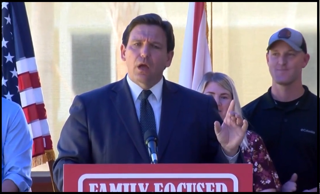
Today, during a press conference to announce state sales tax relief, Florida Governor Ron DeSantis fired back at those who are targeting him.  WATCH: 

.

The transport of the alien arrivals to Martha’s Vineyard was a great way to bring attention to the national border crisis.